Introduction
World Region Map https://images.flatworldknowledge.com/berglee/berglee-fig01_010.jpg
A region is a basic unit of study in geography—a unit of space characterized by a feature such as a common government, language, political situation, or landform. A region can be a formal country governed by political boundaries, such as France or Canada; a region can be defined by a landform, such as the drainage basin of all the water that flows into the Mississippi River; and a region can even be defined by the area served by a shopping mall. Cultural regions can be defined by similarities in human activities, traditions, or cultural attributes. Geographers use the regional unit to map features of particular interest, and data can be compared between regions to help understand trends, identify patterns, or assist in explaining a particular phenomenon.
Regions are traditionally defined by internal characteristics that provide a sense of place. Their boundaries vary with the type of region, whether it is formal, functional, or vernacular; each type has its own meaning and defined purpose. -http://open.lib.umn.edu/worldgeography/chapter/1-1-geography-basics/
Task
Toggle between this map of world belief systems http://d3tt741pwxqwm0.cloudfront.net/WGBH/sj14/sj14-int-religmap/index.html and this map of world languages http://langscape.umd.edu/map.php.
Also use this website http://www.worldbank.org/en/about/annual-report/regions (World Bank) to get some additional information about each region.
Explain what the major religion and the major language of each of these world regions is...
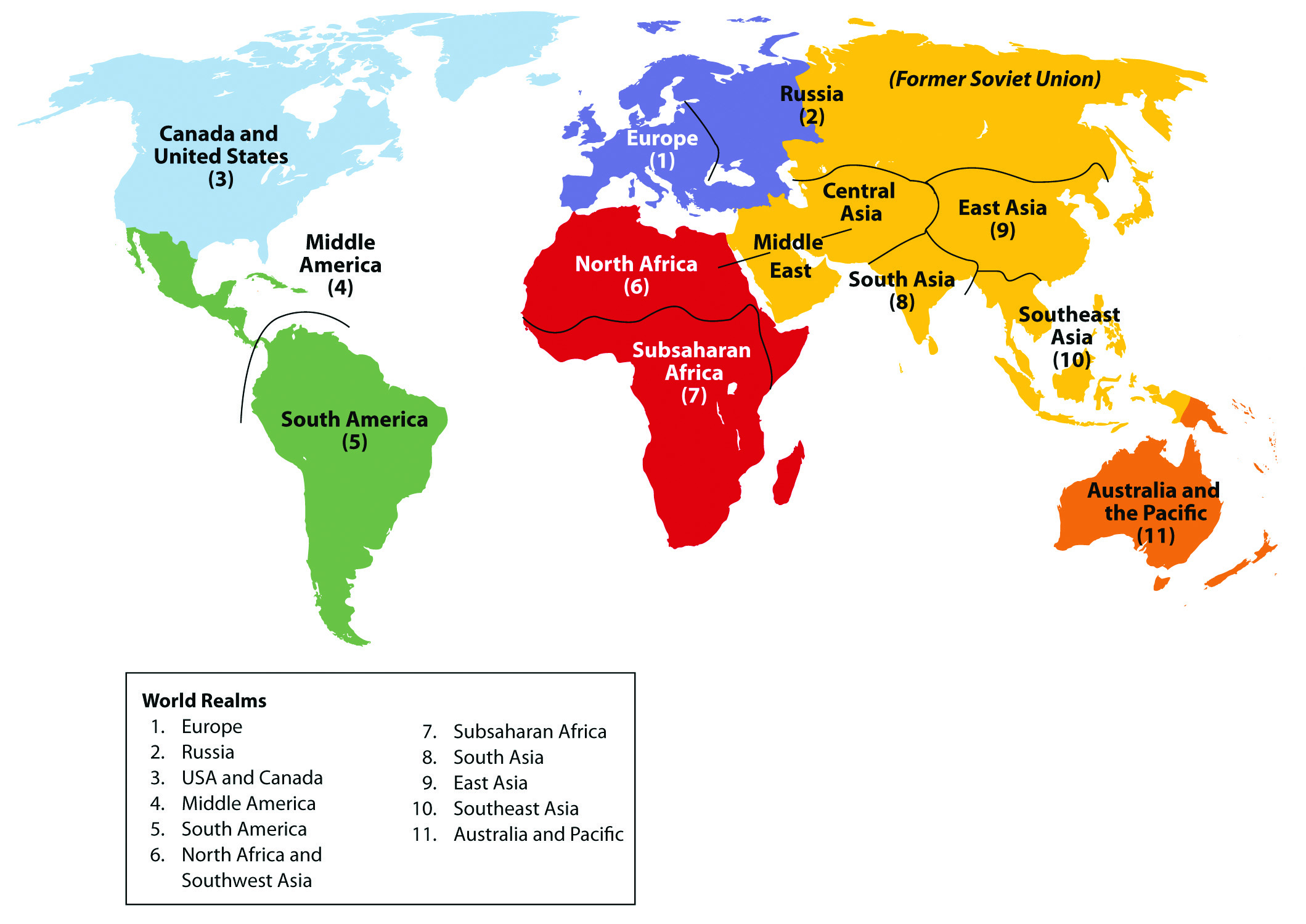
1-North America
2-Central America
3-South America
4-Europe
5-Russia
6- Sub-saharan Africa
7-Middle East (including North Africa)
8-East Asia
9-South Asia
10-South East Asia