Introduction
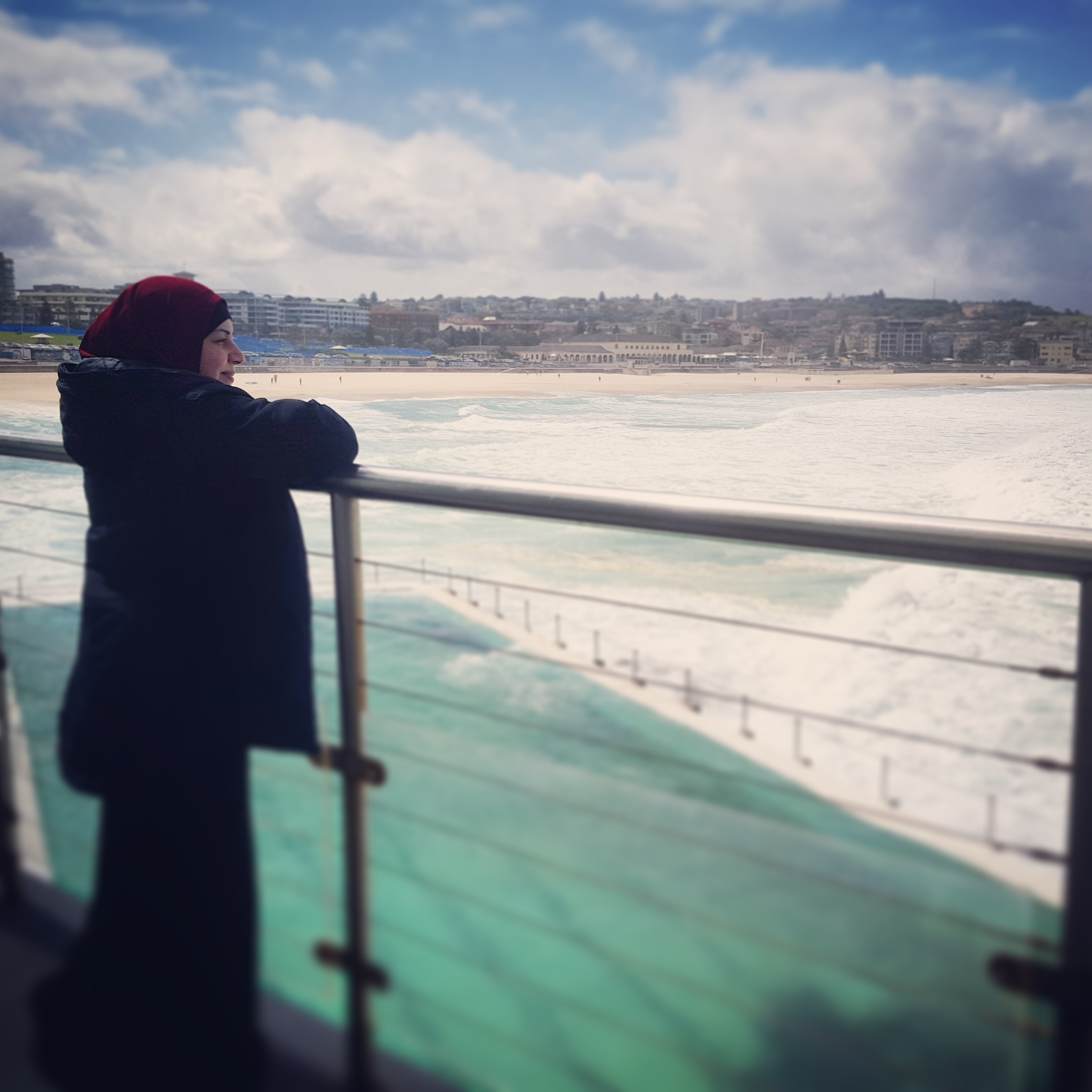
The Virtual Fieldwork is based on the study of the Goegrpahical Processes that Form and Transfrom the Physical World. The area of focus will be on Bondi Beach to Coogee Beach Cliff Top Costal Walk. The following task grasps inquiry-based approaches which underlines critical thinking in order for you to complete the activities and gain the understanding of the geographical features, patterns and interrelationships concerning the natural environment.
Task
What is Required
As geographers in training, this virtual fieldwork will give you the opportunity to investigate the geographical processes that create coastal landforms and how they change over time.
The virtual fieldwork booklet will contain four hours of activities involving primary and secondary data collection. The information collected will need to be uploaded on Microsoft Word. The activities involved will be based on the examination of the landforms and agents which are produced around the coastal site.
Your Booklets should contain:
- a) Description of various features of the landform.
- b) Explain the process and relationships between Erosion and Deposition.
- c) The effects of Weather and Climate.
- d) Comparison on the impacts of natural processes compared to human activities.
Go through and complete all tasks to the best of your ability.
Goodluck and Have Fun!!
Process
Lesson One: Recognize the main landform in this selected study.
Watch the video and complete the following activities.
[video:https://www.youtube.com/watch?v=8aj-1cwTxs4]
Activity 1: Identify and locate the area of study using Google maps and Google earth.
- Where is Bondi beach located?
- What coastal line is being presented in the video?
- Name the surround suburbs.
- Show and label the feature of the coastal slope.
Transfer your maps to you word document when finished.
Activity 2: While watching the video, you are required to create a mind map based on the various features that you see.
Access: https://www.mindmeister.com/au
Once completed download your maps and insert it to your word document.
Activity 3: Draw a sketch on one of the coastal landscape from the video. Identify and label the features of the landform and how they can be classified.
Label the following:
- Stack
- Cliff
- Arch
- Headband
- Bay
- Rocky Platform
Once completed use the class room scanner to transfer it to your word document.
Do not forget to save your Word document. ********************************************************************************************************************************************************************
Lesson Two: Processes that create coastal landfroms.
[video:https://www.youtube.com/watch?v=zUh3WeilFN4]
Activity 1: Watch the video on Erosion and answer the following question.
- What is coastal erosion?
- How long is the coastal erosion process?
- What are the causes?
- When can erosion happen?
- What kinds of rocks are found in the area?
- In what environment did these rocks probably form?
- What is the arrangement of the rocks?
Supported sites in order to help answering the questions.
http://www.coolgeography.co.uk/GCSE/AQA/Coastal%20Zone/Landforms/Erosion%20Landforms.htm
http://www.alevelgeography.com/?page_id=352
Activity 2: View the video and in your own words describe what you understand by the term deposition.
[video:https://www.youtube.com/watch?v=ChEHQUMEkXw]
[video:https://www.youtube.com/watch?v=8aj-1cwTxs4]
- View the video carefully, stop on certain images if need to and locate various coastal features you think are formed by deposition?
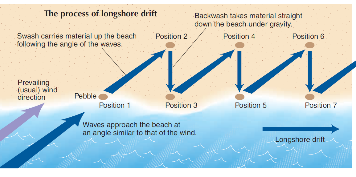
- How does the long shore drift influence the erosion and deposition process?
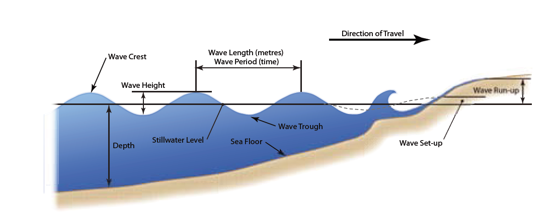
Activity 3: Identify the features of waves and factors affecting their size.
[video:https://www.youtube.com/watch?v=8aj-1cwTxs4]
Video showing wave formation - http://www.bbc.co.uk/learningzone/clips/understanding-wave-formation/4018.html
- Explain how waves cause erosion of shorelines.
- Describe features formed by wave deposition.
- Identify ways to protect shorelines from wave erosion.
By examining all the videos answer the following questions on a word document.
- List the factors that influence the size of wave?
- What is the wave shape?
- Are the waves spilling plunging or suring?
- Can you see a rip? Where is it located?
- How good is the wave clarity, clean dirty polluted sandy?
- What evidence can you see that sand is moved in the surf?
[video:http://www.bbc.co.uk/learningzone/clips/understanding-wave-formation/40…]
Sites that will help you answering questions.
http://study.com/academy/lesson/waves-types-features-effect-on-erosion.html
http://www.coolgeography.co.uk/GCSE/AQA/Coastal%20Zone/Processes/waves.htm
http://www.geography-site.co.uk/pages/physical/coastal/waves.html
Do not forget to save your Word document.
*******************************************************************************************************************************************************************
Lesson Three: The changing of Coastline.
[video:https://www.youtube.com/watch?v=abU02rmVsKA]
Activity 1:
- Why is bondi beach under threat?
- Why is the coast more vulnerable?
- What is the plan retreat policy?
- What is at risk of disappearing and why?
- What factors are increasing erosion?
Source you might find usefull.
Activity 2: Copy and paste two map which shows the Bondi coastline from the time of 2001 to 2015 to your word document. analyse and explain the various changes in both maps and briefly decribe how climate change has impacted the coastline.
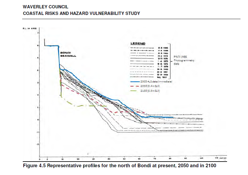
- While obersiving the chart. Describe what you think will happen to the coastline in the year 2050.
Do not forget to save your Word document. ********************************************************************************************************************************************************************
Lesson Four: Natural and human impacts.
[video:https://www.youtube.com/watch?v=abU02rmVsKA]
[video:https://www.youtube.com/watch?v=8aj-1cwTxs4]
[video:https://www.youtube.com/watch?v=nujYG_b8lI8]
Activity 1: While re-viewing the video. What are some of the ways you can see that humans or natural resources can reduce the impacts of ersosion.
| Solution | Description | Diagram | Advantages | Disadvantages |
Copy and paste your charts on a word document in order to complete the activity.
Activity 2: Take notes from the video and describe how human interactions is overtime.
[video:https://www.youtube.com/watch?v=8aj-1cwTxs4]
[video:https://www.youtube.com/watch?v=ZPVtdOX65fc]
- What impacts have people had on the coast over time?
Collecting secondary information.
- Does the communit have a say on how the beach is managed?
- Does the councils coastal management policy refelect an understanding on the effects of the physical processes?
Sources you might find usefull:
http://sydneycoastalcouncils.com.au/sites/default/files/strategicplan20…
http://www.waverley.nsw.gov.au/environment/water_and_coast/coastal_mana…
https://news.google.com/newspapers?nid=1301&dat=19891026&id=gbQnAAAAIBA…
http://www.skwirk.com/p-c_s-16_u-140_t-414_c-1451/coastal-management/ns…
ALL DONE!!!
Do not forget to save your Word document. ********************************************************************************************************************************************************************
Evaluation
|
Outcome |
Difficulty 0-5 |
Developing 5-10 |
Competent 10-15 |
Highly Competent 15-20 |
Advanced 20-25 |
|
Content |
Very little detail and understanding of the task.
Makes limited observations of the coastal processes being investigated
Information is very limited as no evidence is present to support the topic. |
Demonstrating limited use of geographical tools
Makes some observations about coastal processes being investigated
Incomplete evidence to support information of the task.
|
Uses some geographical tools to gather information associated with coastal processes of the chosen area for investigation
Collects some evidence and makes some deductions from the evidence which relate to the coastal processes under study
|
Uses geographical tools to identify and gather information relating to coastal processes of the area for investigation
Identifies evidence and draws some accurate conclusions, relating the implications of the evidence |
Uses a range of geographical tools to clearly identify, gather and record information relating to the coastal processes of the area chosen for investigation
Analyses the evidence to draw accurate and logical conclusions and relates the implications
|
|
Research |
Limited sources of information used for research. |
Draws simple conclusions about the geographical issue from the information collected
|
Presents a written report that identifies and communicates some geographical information about coastal processes of an area chosen for investigation |
Presents a written report that clearly identifies and communicates geographical information associated with the coastal processes of the chosen area for investigation |
Presents a detailed written report that clearly identifies and communicates geographical information associated with the coastal processes of the chosen area for investigation
|
|
Report Presentation |
No attempt made to structure the report
|
Poorly and/or ineffectively structured |
Generally structured and organized |
Mainly structured and organized in order to aid the reader. |
Wisely uses headings, sub-headings and other organizational methods (such as tables, charts, diagrams) |
Conclusion

Well Done!!
You have now just completed your hanbooks. Throughout your virtual experience, you have now gained the geographical skills and knowledge to demostrate a sense of place about Australian Coastal enviorment.
All information, sketches and data saved on your word document and publication needs to be printed with a cover page. Your hanbooks will be needed in order to support your future tasks.