Introduction
In this webquest you will be exploring different maps! At the end of the exploration, you will create a map of our classroom!
Task
During this webquest you will go through 3 steps. You will explore different maps and why map keys are important. Then you will discuss different maps. Finally, you will create your own map of our classroom. Be sure to read all of the directions.
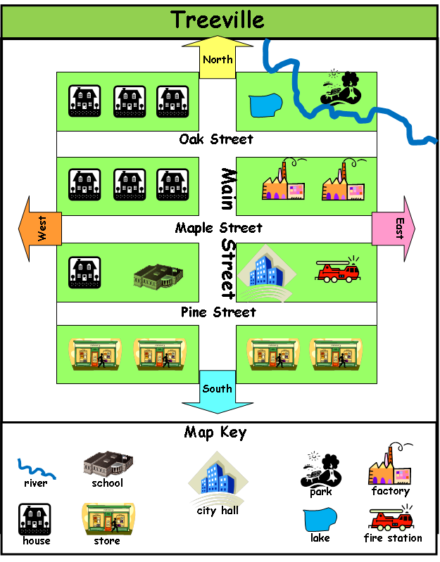
Example of Classroom Map

Process
Step 1: Explore the "Reading a Map" site. Be sure to read each page with your group.
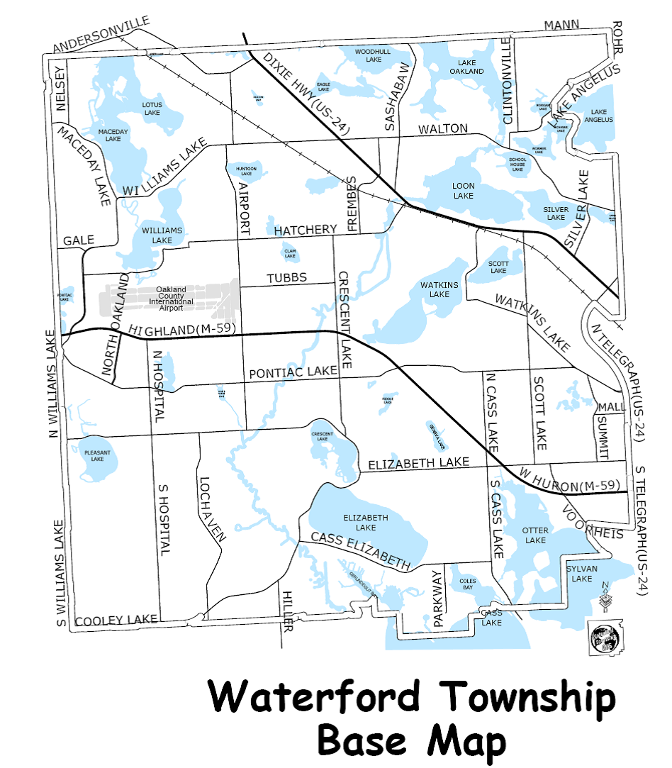
Step 2: Look at the Map of TreeVille and Waterford. Talk to your group about how the two maps are different.
Step 3: It's time to make a map of our classroom!
In your classroom map you must include a title, key, and important areas of our classroom. Use color to make your map very clear.
Evaluation
Your group will be graded based on the following:
|
| CATEGORY | 4 | 3 | 2 | 1 |
| Title | Title tells the purpose/content of the map, is clearly distinguishable as the title (e.g. larger letters, underlined, etc), and is printed at the top of the map. | Title tells the purpose/content of the map and is printed at the top of the map. | Title tells the purpose/content of the map, but is not located at the top of the map. | Purpose/content of the map is not clear from the title. |
| Map Key | Key is easy-to-find and contains a complete set of symbols, including a compass rose. | Key contains a complete set of symbols, including a compass rose. | Key contains an almost complete set of symbols, including a compass rose. | Key is absent or lacks several symbols. |
| Labels & Features - Neatness | 90-100% of the labels/features can be read easily. | 89-80% of the labels/features can be read easily. | 79-70% of the labels/features can be read easily. | Less than 70% of the labels/features can be read easily. |
| Labels - Accuracy | At least 90% of the items are labeled and located correctly. | 80-89% of the items are labeled and located correctly. | 79-70% of the items are labeled and located correctly. | Less than 70% of the items are labeled and located correctly. |
| Color Choices | Student always uses color appropriate for features (e.g. blue for water; black for labels, etc.) on map. | Student usually uses color appropriate for features (e.g. blue for water; black for labels, etc.). | Student sometimes uses color appropriate for features (e.g. blue for water; black for labels, etc.). | Student does not use color appropriately. |
| Spelling/Capitalization | 95-100% of words on the map are spelled and capitalized correctly. | 94-85% of the words on the map are spelled and capitalized correctly. | 84-75% of the words on the map are spelled and capitalized correctly. | Less than 75% of the words on the map are spelled and/or capitalized correctly. |
| Scale - 4.0 Opportunity | All features on map are drawn to scale and the scale used is clearly indicated on the map. | Most features on map are drawn to scale and the scale used is clearly indicated on the map. | Many features of the map are NOT drawn to scale even though a scale is clearly indicated on the map. | Many features of the map are NOT drawn to scale AND/OR there is no scale marker on the map. |
Conclusion
Students will share their maps with other groups of students. Students will practice giving feedback to one another during the sharing out.
Credits
National Park Services. http://www.nps.gov/webrangers/activities/readingmap/readingmap.swf
Oakland Schools ISD. Where is my Community? What does it look like? https://oaklandk12-public.rubiconatlas.org/Atlas/Develop/UnitMap/View/D…;
Teacher Page
Michigan State Standards for this Unit
A * denotes that this standard is covered in the webquest.
State Standards:
*2 – G1.0.1 Construct maps of the local community that contain symbols, labels, and legends denoting human and natural characteristics of place.
*2 – G1.0.2 Use maps to describe the spatial organization of the local community by applying concepts including relative location and using distance, direction, and scale.
*2 – G2.0.1 Compare the physical and human characteristics of the local community with those of another community.
2 – G2.0.2 Describe how the local community is part of a larger region (e.g., county, metropolitan area, state).
2 – G4.0.1 Describe land use in the community (e.g., where people live, where services are provided, where products are made).
2 – G4.0.2 Describe the means people create for moving people, goods, and ideas within the local community.
2 – G5.0.1 Suggest ways people can responsibly interact with the environment in the local community.
2 – G5.0.2 Describe positive and negative consequences of changing the physical environment of the local community