Introduction
Introduction:
The Australian continent can be subdivided in various geographical ways, including through climate, weather, natural resources and vegetation. One of the ways of seperating Australia's physical environments is by its topographic drainage divisions and river regions.
In 1997, the Australia's River Basins project established a national spatial database of major hydrological basins, with basin boundaries defined by the Australian Water Resources Management Committee.
The project concluded that the Australian continent is divided into 12 drainage divisions that are sub-divided into 77 water regions and then into 245 river basins.
The following link has a map of Australia depicting these divisions: http://www.bom.gov.au/water/geofabric/documents/BOM002_Map_Poster_A3_Web.pdf
This Webquest introduces students to the focus area "Physical characteristics that make Australia unique" in the stage 5 mandatory unit Investigating Australia's Physical Environments through a case study of Toongabbie Creek and an investigation about how it links in with Australia's drainage basins.
Students will use the resources provided in this webquest to conduct virtual fieldwork around Toongabbie Creek in order to:
- Identify the interrelationships of geographical processes within this physical environment,
- Examine how flora and fauna have adapted to the environment, and
- Analyse the interactions of people with this environment.
The purpose of this online instructional unit is to provide students with the oppurtunity to develop an understanding of how geographical features and processes in an environment relate to a greater Australian context. Students will demonstrate geographical skills through their intepretation of photographs and maps, as well as develop skills in research, analysis, synthesis and evaluation in order to complete a virtual fieldwork booklet in preparation for their case study assessment.
Task
Task:
Description:
This webquest contains a virtual fieldwork study with four hours worth of activities surrounding Toongabbie Creek and it's associated geographical factors. Throughout the course of this webquest, students will examine:
Place: the historical and contextual significance of the creek and it's features.
Space: the significance of the location of the creek and its distance from urban areas.
Environment: the geological, atmospheric, hydrological, geomorphic, edaphic (soil), biotic and human processes relevant to the region.
Interconnection: How the creek is connected to the greater South East coastal drainage division and river region and how it connects / seperates different localities in the area.
Scale: The way geographical processes can be examined at different levels, e.g. from a local, regional, state and national level.
Sustainability: The capacity of the creek to sustain native flora and fauna as well as its ability to efffectively function as a means of drainage.
Change: What changes in geographical phenomena have developed over time.
Each activity in this webquest should take between 30 mins and an hour.
On completion of all of the activities in this webquest in a virtual fieldwork booklet, students will go on to participate in two post-virtual fieldwork lessons that conclude their research of the creek and help them synthesise the information they gathered to prepare for their own case study assessment
Students will be expected to hand in their completed virtual fieldwork booklet for marking as a part of their final assessment.
Process
Process:
Introduction to Virtual Fieldwork in Toongabbie Creek
Before you are introduced to your case study on Toongabbie Creek, it is important to have an understanding of the geographical dimensions of Australia, as well as a knowledge of the origins of the continent from both a geographical and Aboriginal perspective. So before you get started, please read chapters 1 - 4 about Australia's Physical Environment on Skwirk.
Activity One: Place
Of Australia's four landform regions, Toongabbie creek is located in the coastal lowlands of Eastern New South Wales.

Looking more closely at the coastal lowlands in New South Wales, you can see that the creek is situated in the Greater Sydney Basin.

To understand Toongabbie Creek as a physical environment, this comprehension task gets you to read about the history of Toongabbie creek and answer questions about the history of its climate, biodiversity and Aboriginal and European settlement in order to make sense of how the creek and its surrounds have changed under the influence of urbanisation and other human interactions in recent years.
*
Go to this site and read through the history of Toongabbie and Old Toongabbie. Copy and paste the following questions into a new document and answer them as you are reading.
http://dictionaryofsydney.org/entry/old_toongabbie_and_toongabbie
1) Why did the indigenous people regard the area around Toongabbie creek as a suitable place to live?
2) What four food sources came from the freshwater creek for the indigenous people?
3) What other sources of food came from the surrounding bushland?
4) What four types of trees were common in the patches of bushland surrounding the creek?
5) Where can some of these original patches of bushland still be found in the area?
6 a) In what year did Arthur Phillip outline that a new settlement had been formed?
6 b) Why was the new settlement called Toongabbee?
7) In 1792, what was the land around Toongabbie primarily being used for? How many hectares of land was used for this purpose?
8)When was the Parramatta / Blacktown extension of the railway opened?
9) In what year was the post office firmply established in Toongabbie?
10) In what year was the first school established in Toongabbie?
11) What was notorious for happening to the Old Windsor Road between Parramatta and the Hawsbury?
12) When was the name of the suburb changed from Toongabbee to Toongabbie?
Activity 2: Space
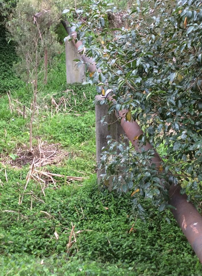
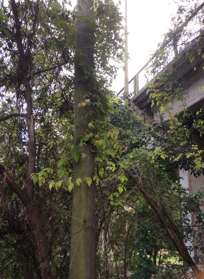
Having been the third settlement in the colony (after Sydeny Cove and Parramatta) and the site of the Government Farm established by Governor Phillip in 1791, Toongabbie has since grown from a predominantly agricultural area into a modern residential suburb. In much of the suburb, houses back onto the bush immediately surrounding the creek, with a mere 20 - 30 metres between the bank and the back fences of homes in Old Toongabbie, Northmead and Winston Hills. As a result of it's proximity to houses, the creek and it's surrounding bushland serve a variety of purposes, including recreational use and as a location for some of the suburbs gas mains.
Following pictures show the walking track beneath Hammers Road Bridge and one of the gas mains.
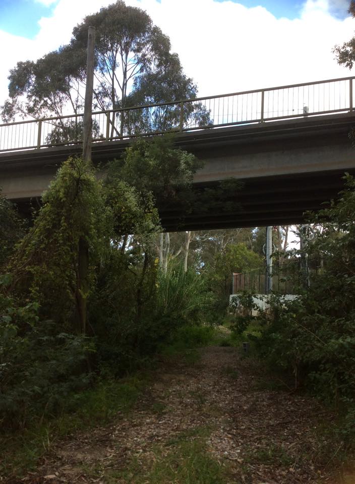
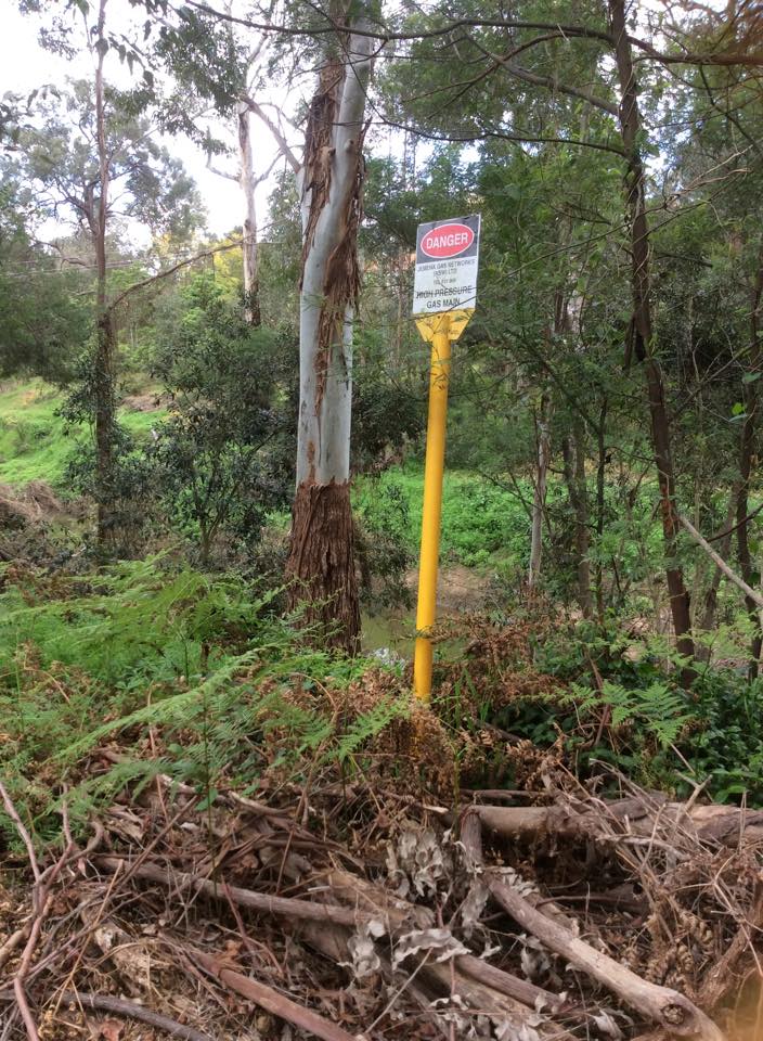
The following video demonstrates the distance from the creek to the back of people's houses.
https://www.youtube.com/watch?v=uIa9vSPiHF4
Write a paragraph describing a potential hazard that could arise from the houses being situated so close to the creek.
Activity 3: Environment
Go to the following website and read the information in order to fill in the close passage about the geological, atmospheric, hydrological, geomorphic, edaphic (soil), biotic environment and human processes of Toongabbie Creek and its surrounding bushland.
http://www.uprct.nsw.gov.au/HTML/Info%20Sheets/Sub-catchment/S8%20-%20Toongabbie%20Creek.htm
CLOSE PASSAGE:
Toongabbie Creek is one of the ___ main creeks, (the other being ________ _____ _____) into which most of the creeks enter before they join the Parramatta River.
The creek varies from a ________ lined ____ _________ and polluted drain in the industrial areas in the upper reaches to mostly natural condition on a natural _________ bed at the lower end.
In the _____ and _____ reaches Toongabbie Creek flows through sandstone terrain of the _______ ______ and in the middle section, through the Seven Hills industrial areas it is in _________ _____ of the Cumberland Plain.
The shales of the __________ _____ are generally composed of _________, ___________, and ___________ ______ with sparse sandstone lenses. The sediments were laid down in a coastal alluvial plain during the middle Triassic, (200Ma).
The _______ _______, in the north of the catchment, is made up of Hawkesbury Sandstone.
________ caused by increased stormwater run off and residential development in the flood plains causes problems insome areas such as parts of __________ and ______________.
The Toongabbie Creek sub-catchment soils are generally fine-grained _____ and _____. The predominant soil landscapes are _________ in the south and _________ to the north of the Toongabbie River. These soils have been formed respectively by ________ and erosional geomorphic processes. They are generally of ___ fertility and less than ___ cms in depth. In the _____ reaches of the tributary creeks, a much deeper, ______ ____ is evident along the creek easements.
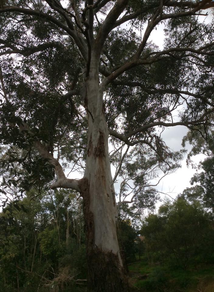
The ____________ of the Toongabbie Creek corridor is remarkable in the context of an _________ environment. _____ distinct communities occur along the catchment, each of these is considered to be rare and endangered at ________, _____ and ________ level. The three communities are:
-
Cumberland Plain Woodland. Including such species as _______ ____, ______ ___ ____ and ____ ___. The Sydney Water Site contains regenerating woodland dominated by Grey Box, Forest Red Gum and Narrow-leafed Ironbark
-
Shale/Sandstone Transition Forest This includes a mix of ____ ___ and ____ ___.
-
Blue Gum River-flat Forest including some impressive large ____ ____ on the creek flats and __________ and Forest Red Gums on the lower slopes. Remnants of this forest remain in _____ __________ Reserve and Hammers Road Reserve with _____ species being noted including Sydney _____ ______, Rough-barked Apple, Grey Myrtle and _____ ___-___.
Although there are significant remnants of native forest along the creek, the density and vigour of ____ growth, in particular _______ ____ and ________ ___, in the lower reaches of the creek, reduces the regeneration of younger plants and has caused some species to disappear altogether. The lower reaches of the creek are also degraded by ______.
Vigorous weed cover provides habitat, albeit poorer quality, for native animals such as _______, _____ _______ and a variety of birds.
__% of total flow volume leaves the catchment in only 2% of the time. The average ___ weather flow across the catchment is ____ litres/hectares/day.
The highest average rainfall occurs in the _____-____ section of the catchment, (headwaters of Darling Mills Creek, _____mm per year) and the lowest in the _____-____, (headwaters of Toongabbie and Greystanes Creek, ___mm per year).
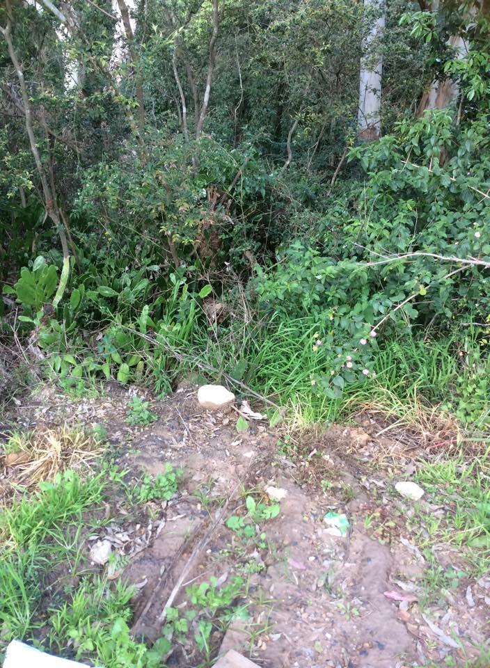
The Toongabbie Creek corridor is used for _______ __________, mainly walking and as a natural adventure playground for children. An _______ _____ follows the creek from Hammers Road to Oakes Road and is a beautiful, if somewhat weed overgrown walk through Blue Gum River-flat Forest. However, through _____ _____ the creek flows through an __________ ____ and is severely degraded due to litter, weeds and engineering.
Activity 4: Interconnection
Using google maps, find the locations of the following and record their coordinates. The first one has been done for you.
- Where Toongabbie Creek meets Blacktown Creek: McCoy Park, 33°46'43.3"S 150°57'08.6"E
- Where Toongabbie Creek meets the Darling Mills Creek:
- Where Toongabbie Creek begins at Crestwood Reserve:
- Where Toongabbie creek meets Quarry Branch Creek:
- Where Toongabbie Creek seperates Northmead from Constitution Hill:
- Where Toongabbie Creek seperates Old Toongabbie from Winston Hills:
- Where Toongabbie Creek seperates Northmead from Westmead:
- Where the Toongabbie / Darling Mills creeks meet the Parramatta River:
- Where Parramatta River meets Sydney Harbour:
At what point does Toongabbie Creek join in with the greater river region of the Sydney Basin?
Activity 5: Scale:
Due to the nature of the creek and its surrounding suburbs being situated in a floodplain, the preventation of flooding and implementation of appropriate mitigation strategies is a vital concern to both local and federal levels of government.
Using the information from the sites below, as well as your own research, construct a concept map that shows how both the natural geography and urban development of the areas surrounding the Toongabbie Creek catchment makes it prone to flooding, and what mitigation strategies have been implemented to prevent / effectively deal with each of the risks you have identified.
http://www.uprct.nsw.gov.au/flood_mitigation/projects/mccoy.htm
http://www.uprct.nsw.gov.au/HTML/Info%20Sheets/Enviro%20Issues/E4%20Flooding%20issues.htm
http://www.uprct.nsw.gov.au/flood_mitigation/publications/facts_about_flooding.pdf
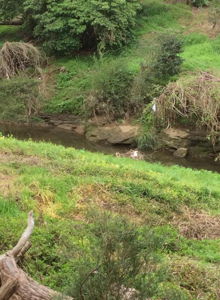
Activity 6: Sustainability
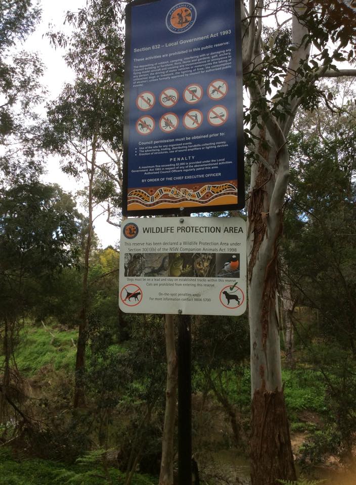
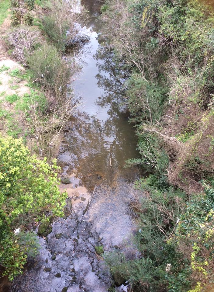
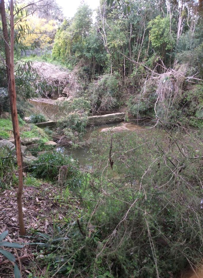
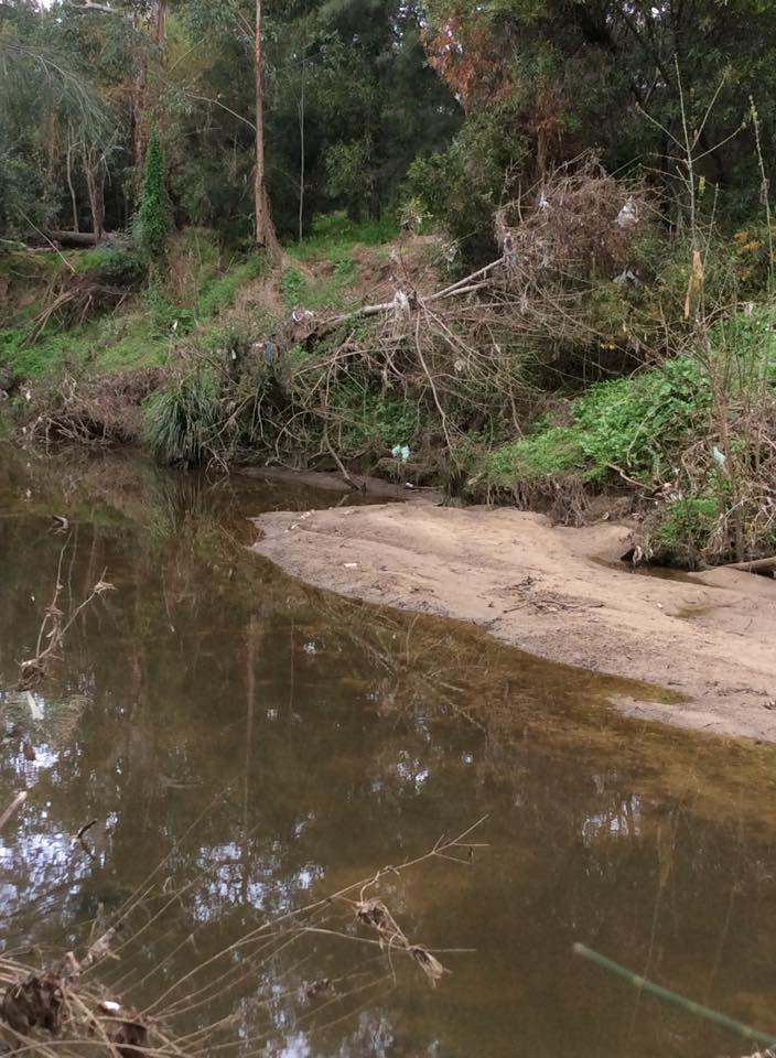
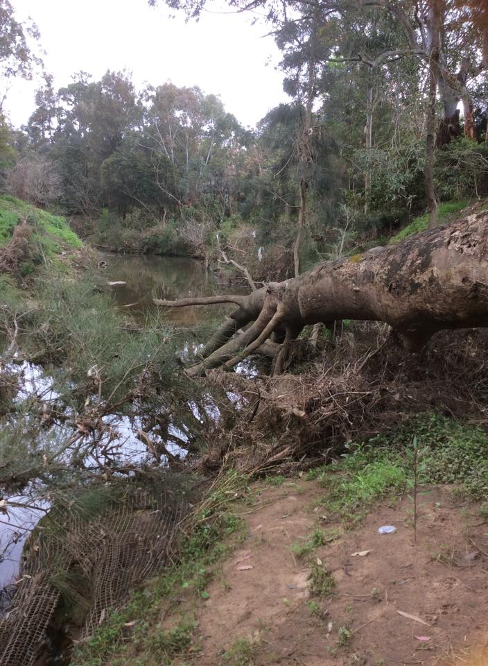
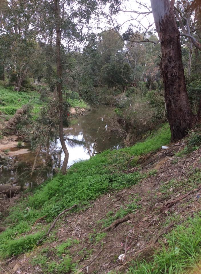
In each of the images below, describe the threat to sustainability and pose an intervention method that could be undertaken to manage the issue and reduce the risk of it recurring.
Activity 7: Change
Using your knowledge of the regions geographical context and history of colonial settlement, draw up an A4 table of the changes that have occured since colonial settlement. Some of the changes you should include are how the vegetation has changed, how the area surrounding the creek has changed, how the native flora and fauna have changed, and how the uses of the creek have changed.
Here are a few more useful sites to get you started:
http://www.parracity.nsw.gov.au/__data/assets/pdf_file/0018/4725/ToongabbieMasterPlan.pdf
http://www.uprct.nsw.gov.au/water_quality/publications/streamwatch/streamwatch_report.pdf
http://parramattariver.org.au/wp-content/uploads/estuaryprocesses2010/b%20Section_2_Historical.pdf
Using the information you have gathered in your table, write a one page response to the following question:
How has the physical environment of Toongabbie Creek changed over time?
Evaluation
Evaluation:
The Virtual Case Study booklet students complete throughout the four hours of virtual fieldwork activities will comprise 5% of their total mark for their case study assessment which is due in week 9.
Students will be evaluated on their ability to complete all the tasks set in this webquest and are encouraged to work through the webquest in their own time, students will not be penalised for not completing the activities within the four hours of class time, as long as they have completed everything in the webquest by week 6.
Conclusion
Conclusion:
On completion of this webquest, students will have achieved the following outcomes:
5.1 identifies, gathers and evaluates geographical information
5.2 analyses, organises and synthesises geographical information
5.3 selects and uses appropriate written, oral and graphic forms to communicate geographical information
5.4 selects and applies appropriate geographical tools
5.7 analyses the impacts of different perspectives on geographical issues at local, national and global scales
5.8 accounts for differences within and between Australian communities
5.10 applies geographical knowledge, understanding and skills with knowledge of civics to demonstrate informed and active citizenship.
Credits