Introduction
Hi there! Have you ever looked around and noticed the different shapes of the land around you? Some places are high like mountains, some are flat like plains, while others have flowing rivers and beautiful valleys. These natural features are called landforms.
In this exciting WebQuest, “Types of Landforms Around Me,” you will become a young explorer traveling across Jamaica to discover amazing landforms found in our environment. Along your journey, you will learn how landforms are formed, how they affect the way people live, and why they are important to our country and the world.
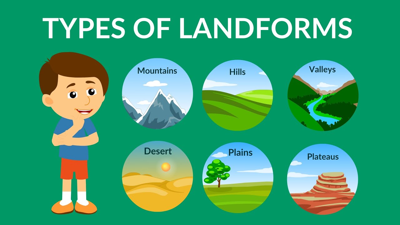
You will watch videos, explore websites, solve clues, and work together with your classmates to investigate different landforms such as mountains, rivers, valleys, hills, plains, plateaus, and beaches.
Get ready to think like a geographer, work like an explorer, and discover the beauty of the world around you!
Task
Students will work both individually and in groups to complete exciting activities that help them understand what landforms are, how they form, and how they benefit people and the environment. Throughout the WebQuest, students will learn about different types of landforms and explore their importance in everyday life.
Students will:
- Learn what landforms are.
- Research different types of landforms.
- Identify examples of landforms found in Jamaica.
- Work cooperatively in groups to create a short presentation about one landform.
- Explain how people use or benefit from different landforms.
- Complete fun interactive PowerPoint and do challenges along the way.
By the end of the WebQuest, students will develop a greater appreciation for the beauty and importance of Jamaica’s natural physical features while strengthening their teamwork, research, communication, and presentation skills.
Process
Step 1: Students will watch a short video about landforms and how they are made.
Step 2: Explore landforms
Students will visit teacher-approved websites to read and learn about different types of landforms. They will explore information about mountains, valleys, plains, plateaus, rivers, and beaches while learning about their characteristics and importance.
Suggested Websites:
Step 3: Complete a Landform Fact Sheet
Students will complete a Landform Fact Sheet about one chosen landform. The fact sheet should include:
-
Name of the landform
-
Definition
-
How it is formed
-
Characteristics
-
Example found in Jamaica
-
Ways people use or benefit from it
Students will also draw a picture of the landform and label its features to help strengthen understanding.
Step 4: Group Presentation Activity
Students will work in groups to create a short, creative presentation on one landform. Groups may create:
-
A slideshow
-
A poster
-
A mini travel brochure
-
A short role play or skit
Each group member will have a special role depending on what they are doing for their presentation:
-
Researcher – finds information
-
Writer – records important facts
-
Designer – creates visuals and decorations
-
Presenter – shares information with the class
As part of the activity, groups must explain:
-
What is the landform?
-
How is it formed?
-
Why is it important?
-
How people use or benefit from it?
Step 5: Share and Present Findings
Groups will present their projects to the class. During presentations, students in the audience will complete a Landform Explorer Notes Sheet where they record:
-
One new fact learned
-
One interesting Jamaican landform
-
One question they still have
After presentations, the class will participate in a short discussion and reflection activity about the importance of protecting our environment and landforms.
Evaluation
Students will be evaluated based on how well they present their information, demonstrate understanding of the landform they researched, and work cooperatively with their group members. Students are expected to clearly explain the characteristics of their chosen landform, how it is formed, and how people and the environment benefit from it. They will also be assessed on their confidence, creativity, participation, communication skills, and ability to share responsibilities while working as a team to complete the presentation successfully.
Landforms WebQuest Rubric
| Criteria | 4 Excellent | 3 Good | 2 Satisfactory | 1 Needs Improvement |
|---|---|---|---|---|
| Accuracy of Information | Information is completely accurate and detailed about the landform. | Most information is accurate with few errors. | Some information is accurate, but important details are missing. | Information is mostly inaccurate or incomplete. |
| Teamwork | Worked very well with group members and contributed fully to all tasks. | Worked well with group members most of the time. | Participated sometimes but needed reminders to cooperate. | Rarely participated in or worked with the group. |
| Creativity | Presentation is very creative, neat, colorful, and engaging. | The presentation shows creativity and effort. | The presentation has some creative elements. | The presentation shows little creativity or effort. |
| Presentation Skills | Spoke clearly, confidently and explained ideas very well. | Spoke clearly and explained most ideas well. | Spoke softly or had difficulty explaining ideas. | Did not explain ideas clearly or participate much. |
| Understanding of Landforms | Shows excellent understanding of landforms and their importance. | Shows good understanding of landforms. | Shows basic understanding with some confusion. | Shows little understanding of landforms. |
Scoring Guide
-
16–20 = Excellent Explorer
-
11–15 = Good Explorer
-
6–10 = Developing Explorer
-
1–5 = Beginning Explorer
Conclusion
Students will understand that landforms are natural features of the Earth, such as mountains, valleys, rivers, plains, plateaus, and beaches. They will learn that these landforms help shape the way people live, travel, work, and use the environment every day. Students will also explore how different landforms provide resources, support farming and tourism, and influence transportation and settlement patterns.
Through this WebQuest adventure, students will develop a greater appreciation for the beauty and importance of Jamaica’s physical features, including places like the Blue Mountains, rivers, valleys, and coastal areas. By completing activities, challenges, and their Explorer Passports, students will strengthen their research, teamwork, communication, and problem-solving skills while becoming confident young explorers of the world around them.
Credits
This WebQuest was created to help students explore and understand landforms in a fun and interactive way. Information, images, videos, and learning activities were inspired and supported by the following educational websites and resources:
- Britannica Kids
- YouTube educational videos on landforms and physical geography
Special thanks to the students, teachers, and educational content creators who make learning geography exciting and meaningful.
Created by: Shadona Patterson
College of Agricultural Science and Education
Subject Area: Social Studies / Geography
Grade Level: Grade 5
Teacher Page
Overview
This WebQuest, “Types of Landforms Around Me,” is designed to engage students in an interactive and inquiry-based learning experience where they explore different types of landforms and their importance to people and the environment. Students will investigate landforms such as mountains, valleys, plains, plateaus, rivers, and beaches, with a focus on examples found in Jamaica.
Through individual and group activities, students will research, complete a fact sheet, and create a presentation. This WebQuest promotes active learning, collaboration, creativity, and the development of communication and research skills.
Learning Objectives
By the end of this WebQuest, students will be able to:
-
Define the term landform correctly.
-
Identify and describe different types of landforms.
-
Explain how landforms are formed.
-
Locate and give examples of landforms in Jamaica.
-
Describe how landforms are used and their importance to people and the environment.
-
Work cooperatively in groups to complete tasks and present information.
Curriculum Connection
This WebQuest aligns with the Jamaica National Standards Curriculum (NSC) for Social Studies by supporting students’ understanding of:
-
Physical features of the Earth and their characteristics.
-
The relationship between people and their environment.
-
The importance of natural resources and landforms in everyday life.
-
Skills in inquiry, communication, and collaboration.
It also supports cross-curricular integration with Geography and Language Arts through research, writing, and oral presentations.
Technology Integration
Students will use technology to enhance their learning by:
-
Accessing teacher-approved websites for research (e.g., Britannica Kids, Mocomi, National Geographic Kids).
-
Viewing educational videos and images of landforms.
-
Creating digital or multimedia presentations (PowerPoint or similar tools).
-
Using online resources to support understanding of global and Jamaican landforms.
-
Developing digital communication and presentation skills through group work.
Assessment
Students will be assessed using a combination of formative and summative assessments based on:
-
Accuracy of Information – Correctness of facts about landforms.
-
Understanding of Landforms – Ability to explain and describe concepts clearly.
-
Presentation Skills – Clarity, confidence, and organization during presentations.
-
Teamwork – Cooperation, participation, and role contribution in group work.
-
Creativity – Use of visuals, design, and engaging presentation methods.
Conclusion
This WebQuest provides students with a meaningful and engaging way to explore landforms while developing important academic and 21st-century skills. Through research, collaboration, and technology use, students will gain a deeper appreciation for the physical features of Jamaica and the world around them.