Introduction
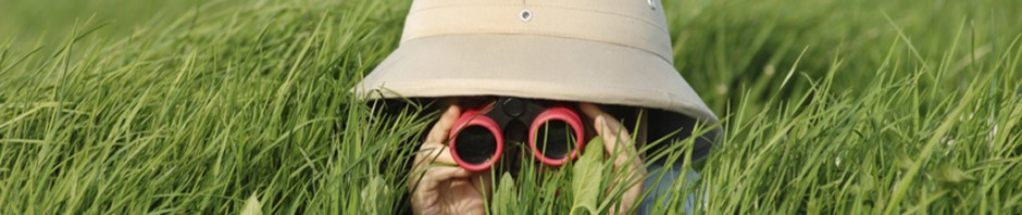
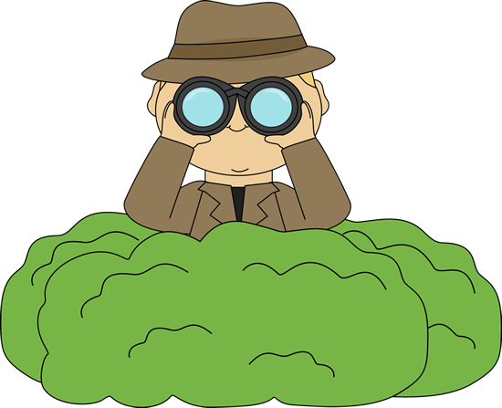
Benny The Explorer Needs Your Help!
Benny has spent the past year traveling all over the world exploring, researching and mapping landforms. Unfortunatley, Benny lost all of his research and map drawings when the strong winds blew them out to sea while he traveled home. Benny needs a team of adventurous explorers to travel the world, document research and findings and map out the landforms that he lost. Are you able to help on this mission?
Task
During This Webquest You Will:
- Meet with the members of your exploration group to determine which land form you would each like to research (1 explorer per landform)
- Research information about your selected landform using the provided website links
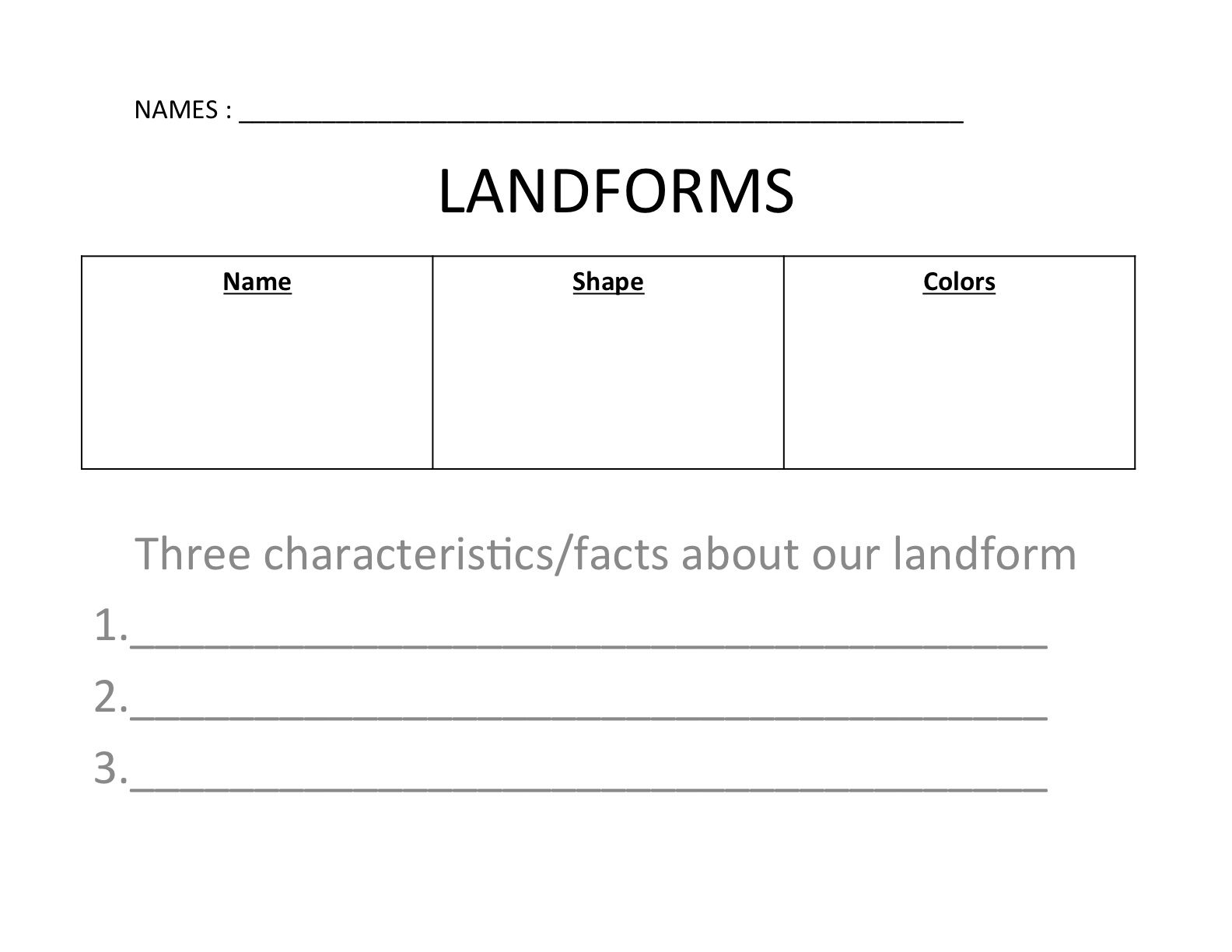
- Report on the research by completing the provided graphic organizer (individually)
- Meet back with your fellow explorers and share the information recorded on your handout
- Create a group map with your exploration team detailing each land form and information.
Process
Ready to start exploring? Let's go!
1. To begin the webquest, the teacher will form exploration groups of 4-5 students. The teacher will also provide the following graphic organizer to record research:
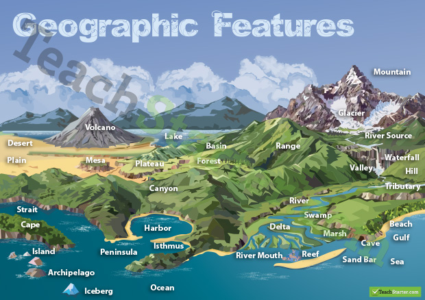
2. Once you have met with your exploration groups, decide which landforms each of you will research from the list below:
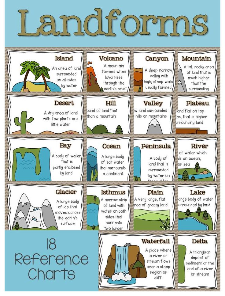
3. Be sure that the members of your exploration group are not researching the same landform! Once it is decided which landform you will research, write the name of landform on the chart on on your graphic organizer.
4. Begin your research! Use the classroom ipads as well as the following links to fill out your graphic organizer about your chosen landform.
http://www.kidinfo.com/science/geology.html
http://science.nationalgeographic.com/science/earth/surface-of-the-eart…
http://www.buzzle.com/articles/types-of-landforms.html
http://www.slideshare.net/shimoki/landforms-and-waterforms?related=2
http://www.edu.pe.ca/southernkings/landforms.htm
5. Once your graphic organizer is complete, check-in with your fellow explorers on their progress. If there are members of your team who are not yet finished, help them in their research.
6. After all members of your exploration group has completed their graphic oragnizer, take turns sharing the research you have found and "teach" your team about your landform.
7. Begin "mapping" out your landforms with your group. You must communicate and work with your group to create a detailed map of the landforms that were researched.
8. Your group map should include:
A.) Title B.) Compass Rose C.) Labels for each landform
9. You will create a map using the materials your teacher has provided for you:
colored construction paper, cardstock paper, scissors, glue, colored pencils and markers
Evaluation
|
| CATEGORY | 4 | 3 | 2 | 1 |
| Title | Title tells the purpose/content of the map, is clearly distinguishable as the title (e.g. larger letters, underlined, etc), and is printed at the top of the map. | Title tells the purpose/content of the map and is printed at the top of the map. | Title tells the purpose/content of the map, but is not located at the top of the map. | Purpose/content of the map is not clear from the title. |
| Map Legend/Key | Legend is easy-to-find and contains a complete set of symbols, including a compass rose. | Legend contains a complete set of symbols, including a compass rose. | Legend contains an almost complete set of symbols, including a compass rose. | Legend is absent or lacks several symbols. |
| Labels - Accuracy | At least 90% of the items are labeled and located correctly. | 80-89% of the items are labeled and located correctly. | 79-70% of the items are labeled and located correctly. | Less than 70% of the items are labeled and located correctly. |
| Knowledge Gained | When shown a blank base map, the student can rapidly and accurately label at least 5 features. | When shown a blank base map, the student can rapidly and accurately label 4 features. | When shown a blank base map, the student can rapidly and accurately label 3 features. | When shown a blank base map, the student can rapidly and accurately label fewer than 2 features. |
Conclusion
Way To Go Explorers!
Explorers, thank you for helping Benny explore, research and map landforms! The research and map you created will help you to remember important information and names of landforms. During this webquest, you have further developed your researching and recording skills, mapping skills, collaboration skills and knowledge on landforms. Benny hopes you had fun virtually exploring the world and wishes you the best of luck in your future explorations!

Credits
Credits
http://rubistar.4teachers.org/index.php?ts=1416521354
http://firstgradematerials.blogspot.com/2013/03/science-graphic-organiz…
http://www.pinterest.com/pin/138415388522469548/
http://www.kidinfo.com/science/geology.html
http://science.nationalgeographic.com/science/earth/surface-of-the-eart…
http://www.buzzle.com/articles/types-of-landforms.html
http://www.slideshare.net/shimoki/landforms-and-waterforms?related=2
Teacher Page
Author: Alissa Conlon, Southern New Hampshire University
Grade: 2nd
Standard: ESS2.B Maps show where things are located. One can map the shapes and kinds of land and water in any area.
Activity: This webquest was designed to actively engage students in exploring, researching and mapping landforms. Students were able to virtually travel all over the world and "visit" each landform from the comfort of their classroom. From this activity, students obtain the content knowledge of landforms as well as master the components and creation of maps. Students also practice their researching and recording skills and communication and collaboration skills.
Process: This lesson requires one period to complete. If needed, the lesson can be broken down into two periods. For the first period the teacher should assign students to exploration groups. The students should meet with the groups and determine the land forms they will research. Research may also be included in the first period by students using the provided websites to complete their graphic organizers. For the second period, students may be finishing their research, or they may be presenting and teaching their research to other members of the exploration group. Students should conclude the lesson by creating a map of the landforms.
Resources:
http://rubistar.4teachers.org/index.php?ts=1416521354
http://firstgradematerials.blogspot.com/2013/03/science-graphic-organiz…
http://www.pinterest.com/pin/138415388522469548/
http://www.kidinfo.com/science/geology.html
http://science.nationalgeographic.com/science/earth/surface-of-the-eart…
http://www.buzzle.com/articles/types-of-landforms.html
http://www.slideshare.net/shimoki/landforms-and-waterforms?related=2